1. Area formerly known as Dixie Camp where the Dixie is docked. The lake shore area is now the North Webster town park and beach. The remainder of the property, known as Dixie Haven, has 5 motel units, an outdoor pool and parking facilities.
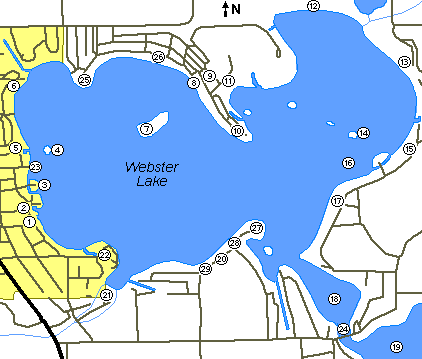
2. Fisherman Cove Resort. Rental cottages, outdoor pool, boat launch, gas pier and bait shop. Tag Huffman (captain 1959-1980) first became interested in the Dixie in 1958 while visiting his brother Bob, who owned Fisherman Cove from 1954-1969. Steve Huffman (captain 1983-1986) lived at Fisherman Cove from 1969-1977.
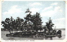
3. Nine's Island.
4. Handley's Island. Also known as Governor's Island, as it was once the summer home of former Indiana Governor Harold Handley (1957-1961). The home on the island was built in 1922.
5. McCoy's Landing.
6. Dallas Landing.
7. The "Big Island". Prior to the 1930's it was known as Muscongus Island, and had a few houses on it. In the 1800's it was known as Kline's Island. Today it is maintained by Epworth Forest. The island has a picnic area, but no permanent dwellings.
8. The Dixie's scheduled landing location at Epworth Forest. Close by is the beach, recreation facility and library building known as "Cokesbury". Epworth Forest is a Methodist church camp which serves the northern Indiana conference.
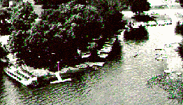
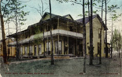
9. Epworth Forest Hotel.
10. Eagle's Point.
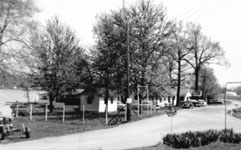
11. The Epworth Forest outdoor amplitheatre. The Dixie would pickup passengers in this protected cove on windy days. In 1955 the Dixie began hosting Epworth Forest's production of "Showboat". Once per year the Dixie became the stage for this off-broadway play. By 1964 the cast and production became too large for the boat. From 1964 through 1980, the Dixie would simply deliver the cast of "Showboat" to this amplitheatre for their annual performance. By 1981 the new owners of the Dixie had cancelled this tradition.
12. Echo Bay Condominiums. This area of lakeshore was undeveloped until the late 1970's.
13. Weimer's Landing. A regular stop for the first Dixie, and a flag stop for the present Dixie (before 1981).
14. Breeck's Island. Also formerly known as Dixie Island. Joseph Breeck lived here until he established Dixie Camp in the middle 1920's. This is where the City of Webster and the first Dixie would dock.
15. Miller's Landing. A frequent flag stop for the Dixies until the 1980's.
16. Stumpy Flats. A dangerous area filled with old tree stumps and other snags. The Dixie was unable to venture into this area until Tag Huffman had a path cut through the stumps in 1962. The lake was lowered 3 feet that year to complete repairs on the dam. This allowed Tag's brother Bob to cut the stumps from a specially equipped pontoon boat.
17. High Banks. The shore in this area has very high bluffs.
18. Webster Bay. Sometimes known as Backwater Bay. The Dixie tours this bay if it is ahead of schedule, or to extend the typical 1-hour cruise into 90 minutes.
19. Backwater Lake. This area was not accessible to excursion boats due to a low bridge between Backwater Bay and Backwater Lake. Strong currents flow into the lake at this location. In the winter, Breeck would dock his boats here because the water did not freeze over. The present Dixie was docked here in the winters until 1950. The Dixie was docked in Fisherman Cove during the winters of 1950 through 1980.
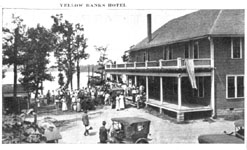
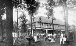
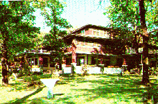
20. The Yellow Banks Hotel. A very grand hotel built in 1902. The original hotel and its wooden rowboats were painted yellow. The rowboats were stored upside-down on the bank in front of the hotel. From across the lake the banks appeared yellow, hence the name "Yellow Banks". This was a scheduled stop for the Dixie until the early 1960's. In the late 1960's the hotel changed owners and fell into dis-repair. It briefly became an Italian restaurant ("Novelli's") in the late 1970's, but was dismantled in 1980. Dillinger and his gang stayed at the Yellow Banks hotel, probably in October, 1933, or April, 1934.
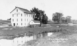
21. The Webster Lake dam. A gristmill was built at this location by Ephriam Muirhead in 1837. This created a large lake by flooding 7 small lakes. Thomas Boydston purchased the gristmill in 1842 (Thomas was a decendant of Dr. Zabdiel Boylston, who invented the small pox vaccine in 1721). For several years the lake created by the mill dam was known as Boydston Lake. By 1879 the lake became known as Webster Lake.
In the 1800's the mill served as a general store and post office. The mill was destroyed by fire in 1949 and the present dam was built in its place.
22. Willis Park.
23. North Webster's "City Street" landing. Also formerly known as Webster Landing. Washington Street is an east-west road running through the center of town. It is simply known as the City Street where it terminates at the lake shore.
24. The Backwater Bridge divides Webster lake from the Backwater lake. Water flows into Webster lake through this area. There is enough current at the bridge to keep the water from freezing-over in the winter. Joseph Breeck would park his boats here for the winter to protect them from the ice. The bridge was replaced by large "tubes" around 1950.
25. Dickerson's Point.
26. Hart's Landing. An impressive series of stone masonry retaining walls are located here.
27. Hayden's Point.
28. Ruple's Beach. A small grocery store was located near the east end of this beach.
29. Culver's Cottages.